4.0 KiB
Wind Erosion
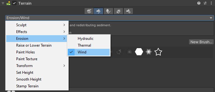
Select a Terrain tile to bring up the Terrain Inspector. In the Terrain Inspector, click the Paint Terrain icon, and select Erosion > Wind from the list of Terrain tools.
The Wind Erosion Tool simulates the effect of wind transporting and redistributing sediment.
The Wind Erosion Tool uses a smooth rotation jitter control, which is slightly different from the standard rotation control. Instead of computing a random rotation value for each frame, this tool uses a smooth noise function to simulate gradual changes in wind direction. Use the Jitter slider in the Brush Rotation section of the Common Brush controls to control the frequency of these rotation changes.
The erosion effect depends on the Terrain size and heightmap resolution. For highly detailed erosion features, use a Terrain heightmap resolution of 1025 or greater.
Parameters
| Property | Description | |
|---|---|---|
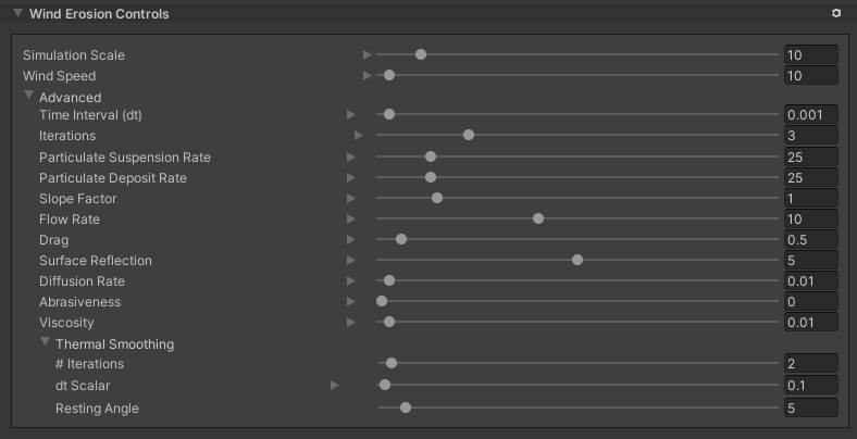
| Simulation Scale | The scale of the simulation, which controls the size of features that erosion produces. Increasing this value results in smoother features, and decreasing it produces higher frequency details. | |
| Wind Speed | The wind speed at the start of the simulation. Higher wind speeds result in a greater visual effect, but might lead to simulation instabilities. | |
| Advanced | ||
| Time Interval (dt) | The time delta for each iteration of the erosion simulation. Higher numbers result in a greater visible effect, but values that are too high can cause simulation instability and inaccuracies. | |
| Iterations | The number of simulation iterations to perform for each Brush stamp. Higher numbers produce more realistic results, but at the cost of performance. | |
| Particle Suspension Rate | The rate at which the simulation removes sediment particles from the Terrain height. | |
| Particle Deposit Rate | The rate at which the simulation deposits sediment particles onto the Terrain height. | |
| Slope Factor | The degree to which the Terrain slope affects sediment suspension. The simulation removes more sediment from surfaces that are more perpendicular to the wind angle.Examples:0 - No effect based on the slope of the Terrain.1 - Full effect based on the slope of the Terrain. | |
| Flow Rate | The rate at which suspended sediment particles travel through the wind flow field. Set this value higher to make sediment travel further and faster. | |
| Drag | The drag coefficient for the wind flow field. Increasing this value will dampen the wind velocity, which results in a smoother effect. | |
| Surface Reflection | The degree to which wind velocities bounce off steep surfaces. | |
| Diffusion Rate | The rate at which suspended sediment diffuses throughout the wind flow field. | |
| Abrasiveness | The rate at which suspended sediment particles erode the Terrain height. | |
| Viscosity | The density of the air, which affects wind fluidity. Higher values slow down the speed of the wind across the Terrain, because the air is thicker. | |
| Thermal Smoothing | After the wind erosion step, you can perform a few iterations of thermal erosion to smooth the Terrain by changing the following parameters. | |
| # Iterations | The number of thermal smoothing iterations to perform. Increasing this results in higher quality thermal smoothing at the expense of performance. | |
| dt Scalar | A multiplier on the time interval to use for thermal smoothing. Increasing this value results in a great smoothing effect, but might lead to simulation instabilities. | |
| Resting Angle | The angle of repose (talus angle). Slopes steeper than this angle are smoothed down until they meet this threshold. |

