2.2 KiB
2.2 KiB
General settings
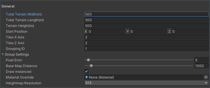
The General settings include basic information you need to create a new Terrain, such as Terrain width, length, height, and number of tiles.
| Property | Description |
|---|---|
| Terrain Width | The total width of the Terrain (in meters along the X axis). |
| Terrain Length | The total length of the Terrain (in meters along the Z axis). |
| Terrain Height | The height of the Terrain (in meters along the Y axis). |
| Start Position | The start position of the first tile (X, Y, Z). |
| Tiles X Axis | The number of tiles along the X axis. |
| Tiles Z Axis | The number of tiles along the Z axis. |
Group Settings
Group Settings let you apply the same settings to new Terrain tiles in a group. Often, a group of Terrain tiles share the same Grouping ID, heightmap resolution, and Material.
| Property | Description |
|---|---|
| Grouping ID | The grouping ID for the new Terrain tiles. |
| Pixel Error | The accuracy of the mapping between Terrain maps (such as height maps and textures) and generated Terrain. Higher values indicate lower accuracy, but with lower rendering overhead. |
| Base Map Distance | The maximum distance at which Unity displays Terrain textures at full resolution. Beyond this distance, the system uses a lower resolution composite image for efficiency. |
| Draw Instanced | Check this box to enable instanced rendering, where Unity uses GPU instancing to calculate Terrain data on the GPU and efficiently render the Terrain mesh. |
| Material Override | A custom Material to render the Terrain with. Specify None to use the default material. |
| Tile Height Resolution | The pixel resolution of the Terrain’s heightmap, also known as Heightmap Resolution. |

